Sunny Hill Park (Barnet)
Brief Description
Sunny Hill Park was formerly Sunnyhill Fields and belonged to Church Farmhouse, whose garden abuts the south end of the park, which also includes an area that was once part of the churchyard of Hendon parish church of St Mary. In 1921 Hendon local council purchased 16 acres for a public park, which opened in 1922. It was enlarged in 1929 when further land was added. The park retains the rural character of the older landscape, with hedgerows denoting former field boundaries and mature trees.
Practical Information
- Previous / Other name:
- Sunnyhill Fields
- Site location:
- Church End, Hendon/Sunnyfields Crescent/Sunny Gardens Road/Watford Way/Great North Way
- Postcode:
- NW4 4NA
- What 3 Words:
- always.aims.salsa
- Type of site:
- Public Park
- Borough:
- Barnet
- Open to public?
- Yes
- Opening times:
- unrestricted
- Special conditions:
- Facilities:
- Sports pitches, playground, café
- Events:
- Public transport:
- Tube: Hendon Central (Northern) then bus. Bus 113, 143, 183, 271, 326.


- Research updated:
- 01/05/2009
- Last minor changes:
- 19/07/2023
Please check with the site owner or manager for latest news. www.barnet.gov.uk
Full Site Description
Sunny Hill Park was once Sunnyhill Fields, lands belonging to Church Farmhouse (q.v.) whose garden the park abuts at the south end. In 1921 Hendon local council purchased 16 acres for a public park, which opened in 1922. It was later enlarged in 1929 when further land was added. It was popular in the 1930s as a place to view air displays at Hendon Aerodrome, which was built in 1910 and famous for its spectacular air displays by early aviators. The aerodrome later became the RAF base and is now the site of the RAF Museum. The south-east part of the park includes an area once part of the churchyard of Hendon parish church of St Mary's (q.v.). The park retains the rural character of the older landscape, with hedgerows that once formed field boundaries and some fine old trees. Sports fields were added and a network of paths laid out. The park has areas of rough grassland managed with nature conservation in mind as well as more formal landscaping with mown grass and scattered trees, including mature oak, ash, willow, birch and avenues of horse chestnut trees.
Sources consulted:
Jan Hewlett, Ian Yarham, David Curson, 'Nature Conservation in Barnet' (London Ecology Unit, 1997).
Further Information (Planning and Conservation)
- Grid ref:
- TQ226900 (522730,190130)
- Size in hectares:
- 21.56
- Site ownership:
- LB Barnet
- Site management:
- Leisure and Youth Services, Green Spaces Division
- Date(s):
- 1921-29
- Designer(s):
- Listed structures:
- None
- On National Heritage List for England (NHLE), Parks & Gardens:
No- Registered common or village green on Commons Registration Act 1965:
No- Protected under London Squares Preservation Act 1931:
No
Local Authority Data
The information below is taken from the relevant Local Authority's planning legislation, which was correct at the time of research but may have been amended in the interim. Please check with the Local Authority for latest planning information.
- On Local List:
- No
- In Conservation Area:
- Yes
- Conservation Area name:
- Church End Hendon (small area in south-east/formerly churchyard)
- Tree Preservation Order:
- Not known
- Nature Conservation Area:
- Yes - Local Importance
- Green Belt:
- No
- Metropolitan Open Land:
- Yes
- Special Policy Area:
- Yes - (south) Area of Special Archaeological Significance
- Other LA designation:
- Premier Park. Article 4 Direction (small area in south-east/formerly churchyard)
Photos
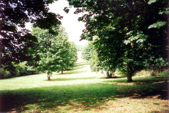
Sunny Hill Park, From Church Farm Museum Gardens, July 2000. Photo: S Williams

2000 
1902 
1900 

Click a photo to enlarge.
Please note the Inventory and its content are provided for your general information only and are subject to change. It is your responsibility to check the accuracy.